
Woodlawn Neighbors, Source by Source
The record layer around a Woodlawn address is split by purpose. Fairfax iCare supplies a parcel-centered property card. JADE, MAR, and other county map tools describe the address and its geometry. A deed or plat can establish the title and legal relationship among parcels. A public voter list has limited statutory fields and a specific access route. Community sites offer local vocabulary and events, not household proof. Read each source for the narrow question it actually answers about Woodlawn neighbors and the block.
| Source | What it shows about a block | Access |
|---|---|---|
| iCare street or wildcard search | Returned property records, owner of record, situs and mailing address, parcel, tax, and assessment fields | Free online; owner names can be withheld and no household list appears |
| iCare line, box, polygon, or buffer | Parcels along a road or within a selected map area | Free map selection; inspect every result separately |
| JADE, GIS, and MAR | Parcel geometry, address authority, aerials, overlays, and adjacent parcels | Free online; map data is not a deed or survey |
| Public voter list | Defined registration fields for a precinct list | Registrar access under Va. Code §24.2-444, with withheld fields |
| PLUS, SRV, and LDIH | Address-linked permits, site plans, construction, and related records | Free online routes, subject to retention and pre-PLUS limits |
| CPAN deed and plat records | Title, easements, subdivision layout, and legal parcel relationships | Subscription or courthouse terminal, with historic repositories for older material |
| Woodlawn Neighborhood Association | Public events, local issues, map context, and contact details | Public web information; no member directory located |
For a street-wide title chain rather than a small block, use the Woodlawn street directory workflow. The map-first method here remains focused on the immediate area around one subject parcel.
Define Woodlawn Neighbors by Parcel
“Adjacent” needs a stated definition before a Woodlawn map result is saved. It can mean that two parcel boundaries touch. It can mean that a parcel centroid falls inside a selected radius. It can also mean that an address appears on the same street segment selected with a line. Those are different sets of property. A small buffer and a polygon are useful when the question concerns actual touching or nearby land; a center-point buffer can include a parcel simply because its centroid falls within the chosen distance.
For a rural or older setting, define the area by a road segment, landmark, tax district, or legal-description term before translating it to current parcel IDs. For a present subdivision, start with the plat and parcel geometry, because an association label may cover more than one road and a ZIP can cover far more than the block. Record the map extent, layer names, date, parcel IDs, and selection method with the result.
Map a Woodlawn Neighbor Block
Use a short, repeatable process for the area around a confirmed Woodlawn address. The map establishes where to look; it does not establish who occupies each dwelling. Start small and expand only when the documented purpose calls for it.
- Search the subject address in Fairfax iCare and preserve the tax-map number, legal description, situs, and owner field.
- Open the parcel in Fairfax GIS or JADE, turn on parcel boundaries, and identify the touching parcels.
- Use Select and Zoom, or choose a small Buffer. Use a polygon for actual or nearby land and note whether a center-point rule was used.
- Cross-reference each selected parcel in iCare instead of treating the map label as a complete property card.
- When title or an easement matters, take the owner, legal description, and parcel reference to CPAN or the courthouse land-record terminal.
Save a map export only as a dated research snapshot. The recorded deed and a licensed surveyor remain the evidence for a precise legal boundary.
Map Woodlawn Neighbor Layers
JADE contains more than 170 layers and offers detailed property reports, map sharing, printing, and current or historical aerial imagery. Parcel boundaries, zoning, flood, school, voting, planning, and public-facility overlays can explain why two nearby properties look related on a map. The county’s Historical Imagery Viewer reaches back to 1937 and includes swipe, measure, and PDF-export tools. These layers provide geographic context, not a complete record of a block’s private households.
MAR is the county authority for site addresses and street names. Fairfax announced its improved MAR application on July 31, 2026, with mobile-friendly address, street, and parcel filters plus exports. That is valuable when Woodlawn’s Fairfax County records use a different format from an Alexandria 22309 mailing line or an older street reference. A no-result in one portal should be documented as a portal result, not treated as proof that an address or person does not exist.
Read Woodlawn Neighbor Parcel Cards
An iCare profile can display owners, parcel information, legal description, sales, values, tax information, map or tax-map number, tax district, land use, acreage, zoning, utilities, road or site description, and historic-overlay details. The owner and tax mailing address are useful leads for the parcel or recorded-title trail. They are not a finding that the owner lives at the property. A mailing address can point to an agent, trust, business, estate, or another location, while the situs describes the parcel itself.
Owner names may be withheld from the public internet record on request. Residential land-use information or an exemption may sometimes provide context, but it is not conclusive of presence at an address. Keep the property card’s access date and tax-map number with any comparison to a deed, plat, or historical listing.
Keep Woodlawn Neighbor Voter Data Limited
Virginia’s online voter-status portal is for a voter or an expressly authorized user. It asks for first and last name, full date of birth, the last four digits of the Social Security number, locality, and an authorization certification. It is not an online street-by-street tool. The portal’s warning explains that unauthorized access can be computer fraud under Va. Code §18.2-152.3, so it should not be used to build a block roster.
Public registration lists are different. Under Va. Code §24.2-444, the general registrar maintains lists that may show name, residence address, year of birth, gender, and applicable election districts. Protected addresses, SSNs, and day and month of birth are omitted. Lists are maintained over time, so note the precinct and list date. For an access question, contact the Fairfax County Office of Elections rather than assuming that an online status check provides public list access.
Woodlawn Neighborhood Association
The Woodlawn Neighborhood Association is a public community layer, not a directory of private households or Woodlawn neighbors. Its GoWoodlawn site describes work toward a thriving business and community environment, offers a community map, and publishes events and contact information. Meetings are listed for the first Tuesday of each month at Classic Foods and by Zoom. The public site uses info@gowoodlawn.com for contact, but no public member roster was located.
See the association’s Woodlawn community map and meeting information before relying on a local label. It is a useful way to understand public events and civic geography around a parcel.
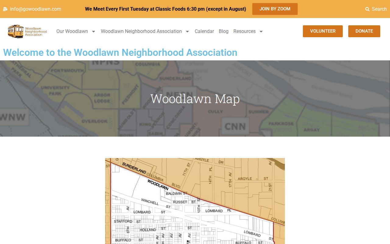
The public association page provides a contact and context layer. It should not be used to infer membership, ownership, or who is present at a particular address.
Mount Vernon Civic Association
The Mount Vernon Civic Association supplies another geographic and civic reference for Woodlawn-area research. The organization says local residents formed it in 1971 and that it grew from roughly 400 to more than 900 households. It participates in the Mount Vernon Council of Civic Associations and the Fairfax County Federation, and its public materials include membership, newsletters, committee news, neighborhood-watch, and community-service information.
| Public association source | Useful Woodlawn-area context | What it does not establish |
|---|---|---|
| Mount Vernon Civic Association | Its area inventory names Belle Rive, Ferry Landing, Villa, Ferry Point Estates, Mount Vernon Forest and Park, Oxford, Riverwood, Vernon Square, Westgate, Wycliffe, Washington Woods, and Yacht Haven. | A private resident directory, a title record, or a current household list |
| Woodlawn Neighborhood Association | Public community map, events, meeting notice, mission, and contact route | Proof of association membership or parcel ownership |
Visit the Mount Vernon Civic Association’s public site to compare its civic labels with parcel geography.
Its stated household scale is association context, not a count for Woodlawn or an indication that any particular parcel belongs to the group.
Read Woodlawn Community Labels Separately
Association pages can help distinguish a subdivision from the broader Woodlawn and Mount Vernon area. Terrace Towne Homes of Woodlawn describes a Mount Vernon-area Alexandria 22309 townhouse condominium community and publishes association information, meeting minutes, and events. Woodlawn Mews publishes the street ranges for Woodlawn Manor Court, Southlawn Court, and Sacramento Drive along with meeting and amenity information. Those pages are useful for public community context, but they are not official ownership rolls.
For historic community context, the Virginia Room’s subject files and local records can be paired with Quaker, Baptist, or association materials. Do not infer a person’s membership from a parcel address. The same caution applies to public congregation and civic-club materials, where no public membership lists were located.
Compare Woodlawn Neighbor Sources
Official sources and commercial neighbor-lookup tools do different things. The official sources are narrower, dated, and tied to a custodian. A commercial category may combine property, marketing, telephone, and public-record data, but it can merge separate households, miss updates, or retain stale address links. A map result should be verified against the parcel card, a recorded deed, or the appropriate public record rather than accepted as a finished answer.
| Source type | Best use around a Woodlawn block | Key limit |
|---|---|---|
| Official county, court, and registrar records | Check a defined parcel, title event, map layer, or statutory list field with an access date | Each record has its own scope, access rule, and possible protected fields |
| Commercial neighbor-lookup category | Surface a lead that still requires independent confirmation | May conflate people, parcels, and dates or include information that is no longer current |
Respect Woodlawn Neighbor Privacy
Parcel and title records do not make a private block open for broad profiling. Renters and other occupants are not listed by public property title. Utility, delivery, and customer data, DMV addresses, protected voter and Address Confidentiality Program records, sealed court files, adoption files, and exempt complaint identities remain outside this kind of search. The Virginia Consumer Data Protection Act can address qualifying covered-business data, but it does not erase official county deed, court, or voter records.
Lawful use. Use Woodlawn neighbor records for personal safety awareness, family history, civic context, or property research. Do not use information from any source to watch, harass, intimidate, or harm another person.